AFTER a very pleasant voyage of twenty days from Sydney, Australia, I arrived in Manila, December 1. At the wharf I was met by Brother R. Caldwell, who has been canvassing in this place for three months. Previously to his work here he had successfully labored in Singapore, Malay Peninsula, and Bangkok, Siam. As the Philippine Islands are now a part of the territory of the United States, and as they are a part of the missionary territory of the Australasian Union Conference, our people in these two countries will have a special interest in learning the condition of things in this interesting field.
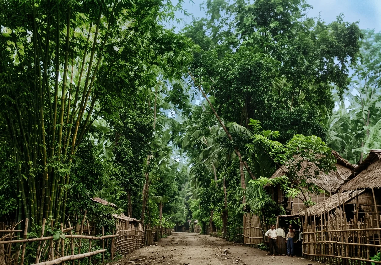
A SCENE NEAR MANILA
This great archipelago lies southeast of China, Manila, the capital, being about six hundred and thirty miles from Hong-kong, and is bounded on the north and west by the China Sea, on the south by the Celebes Sea and Borneo, and on the east by the Pacific Ocean. Its northern boundary is at twenty-one degrees twenty-two minutes north latitude, and its southern at four degrees forty-five minutes north. It lies between the meridians one hundred and sixteen and one hundred and twenty-seven degrees east of Greenwich, a total of 1,152 miles north and south, and 682 miles east and west. The general outlines of the group are those of a triangle, with the base to the south. The large island of Luzon, 480 miles long, is in the northern part, while Mindanao, the second in size, lies in the southeastern part of the group. Between these two lie a number of smaller islands called the Visayas. Extending from near the western end of Mindanao almost to Borneo are the numerous islands of the Sulu Archipelago. Reaching from near the northern point of Borneo in a northeastern direction, and forming a part of the western side of the triangle, is the long narrow island of Palawan, or Paragua, as the Spaniards called it. Between this and the others mentioned is the Sulu Sea. As showing the immense size of the land area of the group, it is only necessary to say that it is seven thousand square miles larger than the combined area of England, Ireland, Scotland, and Wales. Luzon alone is equal to the combined areas of Denmark, Belgium, and Holland; and Mindanao has an area almost equal to Portugal. The Philippines are larger than the States of New York, New Jersey, Pennsylvania, and Delaware. The present population of the group is not far from eight million. Notwithstanding the fact that it is nearly four hundred years since the Spanish flag was raised in the Philippines, some of even the smaller islands have not been surveyed nor thoroughly explored, and the interior of some of the larger ones is entirely unknown.
The people of the Philippines divide themselves naturally into three grand divisions: First, the pagan tribes of the mountains. Upon these the Catholic faith and Spanish civilization made but little impression. Of these tribes may be mentioned the Negritos, who are the aborigines of the northern islands; the Indonesians, who are the aboriginal tribes of Mindanao; the Igorrotes of Luzon, who are the finest of the wild tribes; and a number of smaller tribes that I will not take time to describe or name. Second, the seven tribes, all of Malay origin—the Visayan, Bicol, Tagalo, Pampango, Pangasinan, Ilocano, and the Ibang—who accepted Spanish rule, adopted Spanish civilization, in part at least, and were converted to the Catholic faith. Third, the Mohammedan Malays called Moros, who occupy parts of Mindanao and the Sulu Archipelago.
With the exception of the Negritos, there is good evidence that all these tribes came originally from the Malay Peninsula, and ethnologists believe that their coming here was six hundred or seven hundred years ago. Of the civilized tribes the Tagalos are the most numerous and the most intelligent. At some time before their migration to these islands they had come in contact with Hindu civilization, which, prior to the Christian era, had flourished in Java and the Malay Peninsula, and built the wonderful temples that are yet to be seen in the tropical jungles of Java. When the Spanish came to these islands, the Tagalos had a knowledge of some of the arts of civilization, and even cannon were made by them. Though the educated Tagalo speaks Spanish, the tribe retains its mother tongue, and has quite a literature, even newspapers being published in that language. This tribe is the most numerous of the native people.
The natives of the Sulu Archipelago are all Mohammedans. For centuries their names were a terror to the islands for a thousand miles north and south of their stronghold at Jolo, which was the religious and commercial center of the race. They were fierce fighters and pirates, and though their progress was checked by the Spaniards, they were never reduced to obedience to the Spanish crown.
In addition to the peoples already noticed, there are many thousands of Chinese in the islands. Generally they are the small traders of the towns. There are also many half-castes scattered through the provinces, mestizos, they are called.
History
In the early part of the sixteenth century, Portuguese sailors found their way to the Malay Peninsula, and there learned of the famed “spice islands,” but knew not where to find them. After the discovery of the Pacific Ocean by Balboa in 1513, Ferdinand Magellan went to the king of Spain and offered to head an expedition in search of those islands. Sailing down the eastern side of South America, Magellan passed into the strait now known as the Strait of Magellan, found the Pacific Ocean, and with his little fleet of ships sailed across the great ocean, and in 1521 discovered the southern islands of the Philippine group. Magellan named these islands the San Lazaro Isles. The Spanish flag was raised, and the country claimed for Spain. The Spanish friars who accompanied the fleet at once began to teach the natives the Catholic religion, baptized the king of one of the smaller islands, also many of the people. Soon after this Magellan was killed in a battle which he was waging to assist one of the tribes against another. A monument has since been built on the spot where he was killed, and another one stands on the bank of the Pasig River here in Manila, to keep in memory his exploits. Several years later some of the small islands received the name of Las Islas Filipina, in honor of the crown prince of Spain, Philip by name, who afterward became Philip the Second. This was the King Philip who afterward perpetrated such horrible barbarities in his effort to overthrow the reformed religion in the Netherlands. From the time of Magellan’s voyage14until 1564, four separate attempts were made to secure a foothold in the Philippines, but without results. The next effort was made by General Legaspi, who took with him a Spanish friar named Urdaneta. Legaspi, with the help of his grandson, Salcedo, gradually established the power of Spain in the islands. He made Manila the capital of the whole group, and in 1572 died, leaving a great name. The friar Urdaneta, as captain of the spiritual forces of the expedition, did his part to bring the natives under the dominion of the Romish church. To-day there stands on the Luneta, a beautiful park in Manila, a monument on which are the figures of Legaspi and Urdaneta. The friar is holding aloft a cross, while Legaspi carries a great sword. This is a correct representation of the method of converting the natives of these islands. And the same idea has been carried out too faithfully in all of Rome’s missionary work in all these Eastern lands.