British Central Africa

8%

Review and Herald Publishing Association · Takoma Park Station, Washington, D. C. · Oct 31, 1907

FromReview and Herald, Vol. 84, No. 44.

Read the full edition

British Central Africa

JOEL C. ROGERS
This country is commonly known as Nyassaland, being situated along the western and southern shores of Lake Nyassa. German East Africa joins it on the north and east, Portuguese East Africa on the east and south, and Rhodesia, or British Central Africa proper, on the west. The extent of the country is not great, being only equal to that of Ohio or Kentucky, while its population is about one million.
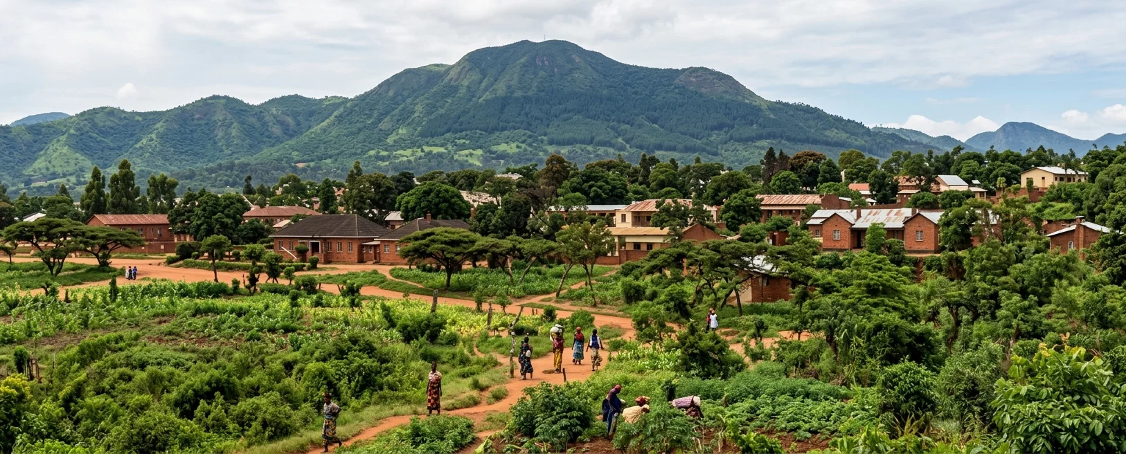
A VIEW OF BLANTYRE, NYASSALAND
Some characteristics of the country are unlike anything I have yet seen. Being in the tropics between nine and seventeen degrees south latitude, vegetation is abundant. Hills and mountains mark the landscape, the mountains being from two thousand to ten thousand feet above sea-level. Low-spreading trees cover these hills and mountains. The trees seldom reach a height of over fifty feet, or a diameter of more than ten inches. Their average size is considerably less. In the valleys and among the hills are many small streams, varying in size with rain or dry weather. On the banks of these streams grow some trees of larger size, which furnish valuable timber for all woodwork done in the country. The leading variety is commonly called mahogany. It takes a rich polish, resembling the dark cherry or walnut of the States. From this tree boards from twelve to twenty-four inches wide are made by native laborers with pit-saws. All white people of Nyassaland use brick for building, and this mahogany for woodwork. When visiting a large brick residence of a planter, the owner told me that every piece of woodwork, including doors, windows, veranda posts, archways, etc., was cut from one mahogany tree. Bamboo also grows along the streams. It is used extensively and for many purposes, the more common uses being for baskets and framework of native houses.
The grass of this land is phenomenal. Woe to the man who, being on a journey, is overtaken by night, and loses his way on the narrow native path. Heavy dew is almost sure to cover this grass. It grows in masses, and often falls in a great tangle. Much patience is required to make one's way through it, even in midday. The average height of this grass is about eight feet on ordinary soil; but if the soil is extra rich, it reaches ten feet. It requires no cultivation. It is less dense under trees, but in open places ten to fifteen tons could be cut from an acre. But it is never cut. It is everywhere, always, so no need of saving. Cattle do well on it, and it is all they require the year round. It is the sole roofing material of native huts, and often of the white man's house as well. Fortunately, it burns off in the dry season. Otherwise, the country would be very unhealthful.
In 1906 the returns of population for Nyassaland gave 976,641 natives, of which 535,528 were female, and 441,113 male. The number of European inhabitants was 611. These consist mostly of government officials, traders, and missionaries.
Considerable effort has been made to establish profitable planting industries. Of these, the principal are tobacco, coffee, and cotton. Rubber planting is now increasing, and will possibly replace some other staples. The cultivation of the soil is done by natives, with a short-handled hoe, solely. Indian corn is the one staple native food product. It is eaten in many forms, but mainly as a thick porridge, or as parched corn. Its native name is chimanga.
Blantyre is the principal town. Its site in the Shire Highlands is considered healthful, and its surroundings are rather beautiful. The white population numbers about one hundred, while thousands of natives live in villages near by. Blantyre is the trading center and mission center of Nyassaland. It had its beginning with the establishment of the Church of Scotland Mission in 1876. My wife and I recently visited this mission, where we were very cordially received. Dr. Hetherwick, for many years at the head of the mission, personally showed us about the place. The nativeschool has nearly four hundred pupils. A hospital for natives and Europeans is also maintained. While showing us the European ward, the doctor said, very kindly, "If you are ever sick,—which I hope you will not be,—you are to come here for treatment."
A railway will soon connect Blantyre with the Zambesi River, when Nyassaland will not seem entirely out of the world. We already have telegraphic connection with South Africa.
The interior postal service is good, though we get “home” mail only once in three weeks. The mail-bags are carried on the native's head. Our Cholo post-office, seven miles from the mission, is on the road from Chiromo,—the river port to Blantyre,—so mail comes to Cholo almost daily. There is also a daily service between Blantyre and Zomba, the government seat, forty miles away. Chiromo is about seventy-five miles from Blantyre.
Though this article is mostly descriptive facts, I trust it will be of interest to our people who support the missionaries in these dark lands, and especially to the young people who are studying missions and preparing to follow.
Cholo, Nyassaland, B. C. A.