G. A. IRWIN

5%

Review and Herald Publishing Association · Takoma Park Station, Washington, D.C. · Jul 11, 1907

FromReview and Herald, Vol. 84, No. 28.

Read the full edition

G. A. IRWIN

From Gwelo to Mozambique, Africa

G. A. IRWIN
FRIDAY evening, March 29, I left Gwelo on the Beira and Mashonaland Railway train for the Port of Beira, on the Indian Ocean, to take the vessel on my homeward trip. Between Bulawayo and Beira, a distance of six hundred and seventy miles, there are three principal stations; namely, Gwelo, Salisbury, and Umtali. Gwelo is the center of a number of gold-mines, and the district is full of ancient workings. It is also the center of government for the district, and home of the native commissioner, and headquarters of the police. The town has an altitude of 4,600 feet, and a white population of 451.
Salisbury has an altitude of 4,825 feet, and a white population of 1,726. The place came into prominent notice during the Matabele war of 1890, when a fort was hastily constructed, and used by the white people for defense. Salisbury is at present the capital of Southern Rhodesia, and also the center of supplies for a number of gold-fields lying between the town and the Zambesi River to the north. A railroad eighty-four miles long connects Salisbury with a group of mines in the Lo Magundi district. The old stage line, running from Beira to the interior, passed through this place. This has now been superseded by the B. & M. R. R., which was completed in May, 1899. Salisbury is also an important missionary center. A general missionary convention was held here a little over one year ago, at which all the societies operating in the northern part of South Africa were represented, either by a delegate in person or by a paper prepared by some representative upon an assigned topic. A paper from Brother Anderson upon the subject of industrial training in connection with mission work, was read before the convention, and called forth a lively discussion, the position taken by Brother Anderson receiving the hearty indorsement of a large number of delegates. I arrived in Salisbury at half-past seven in the morning, where I had to change trains, and wait for over an hour before going on to Umtali.
Umtali is one hundred and seventy miles southeast of Salisbury, and is located just on the border between Southern Rhodesia and Portuguese East Africa. It has an altitude of 3,649 feet, and a white population of 688. In addition to being the distributing center of the gold-fields of British Manicaland and the eastern gate of the chartered companies' territory, it is the headquarters of the Beira and Mashonaland Railroad, whose repair shops are located near the town. This place, on account of its fine water-supply and generally healthful surroundings, is called the “Eden of Rhodesia.”
Leaving here at half-past seven in the evening, our next place was Beira, which we reached at half-past eleven Sunday forenoon, March 31. A distance of fifty or sixty miles inland from Beira, lies one of the most unhealthful regions in all Africa. Much of it is low, marshy land, below the level of the sea, covered with a growth of coarse grass or reeds, at whose base the ground is covered from one to three feet deep with water as black as ink. It is said that even in the dry season, few persons escape fever who spend three successive nights in this region.
The work of building the railroad through this place was all done by Kafirs, but not one of the engineers and foremen escaped fever, and many died.
Beira is built on a sand-bank lying between the ocean and the estuary formed by the junction of the Pungwe and Busi Rivers. Sixteen years ago there was not a house in the place, but now it contains a population of 3,379, divided as follows: whites, 1,438; Asiatics, 287; and natives, 1,654. The natives are all Kafirs, and the finest specimens of physical manhood I saw in all my travels through Africa. Having a fine harbor, and being the seaport outlet of the B. & M. R. R., Beira is rapidly growing into prominence.
The first settlement of the Portuguese on this part of the coast was at Sofala, a few miles farther south, which had been visited by Vasco da Gama in 1502, and where the Portuguese built a fort in 1505. It was then an Arabic town, and famous as the place whence most of the gold brought down from the interior was exported. From the fact that portions of the interior as far back as Mashonaland and Southern Rhodesia are literally honeycombed with ancient workings, and in many places are found ruins of ancient forts and temples, it is supposed that Sofala was the golden Ophir to which King Solomon sent a fleet of ships every three years, and from which he is supposed to have obtained enormous quantities of gold. The glory and importance of the place has now departed, and hereafter the growing town of Beira will be the port whence the products of the interior will find their way out to the different trade marts of the world. A high and substantial sea wall has been built all along the river side of the town to protect it from the strong tide, which has a rise and fall of twenty-two feet.
Owing to the presence of tsetse and hippo flies, whose bite or sting causes the death of horses, mules, and cattle, the traffic of the town is carried on by means of small trams propelled by strong Kafir men over a track two feet wide. The line is owned by a company, and each individual pays an annual rental forthe use of a car, and the privilege of running it on the track.
Early in the morning of April 2, my boat, the “Prinzregent,” belonging to the German East African Steamship Company, arrived, and we were permitted to go on board at 2:30 P. M. The tide was then at its lowest ebb, and we had to go down a long stairway by the side of the sea wall, and pick our way through mud and slime until we came to the small boat that was to carry us and our luggage out to the ship. The water was so shallow that the boat could not be gotten up to the bank by several feet. While I was standing and wondering how we were going to get into the boat without getting our feet wet; all at once a big six-foot Kafir stuck his head between my legs from behind, and before I had time to think what was going on, I found myself on his shoulders astride his neck, being carried through the water and safely deposited in the boat.
At 4:30 P. M. the anchor was taken up, and the “Prinzregent” steamed quickly out of the Beira harbor and headed northward for Chinde, which is located at the mouth of the Zambesi River, where we arrived the next morning at half-past six, and anchored six miles out at sea, there being a sand-bar in front of the place, which prevents vessels of the tonnage of the “Prinzregent” (6,300) from going closer with safety.
There were five missionaries on board, returning to their station in Nyassaland from a vacation at the Cape. These, with some other passengers, were put over the side of the vessel in a large basket, and lowered into the tender below, which was to take them ashore. We lay at anchor all day, waiting for the return of the tender with expected passengers from Nyassaland and the upper Zambesi country. There being no breeze, the heat of the sun was almost unbearable; hence we were extremely glad when the boat returned with the passengers, and we again put to sea.
Since leaving Beira we have been sailing in the Mozambique Channel, which separates the large island of Madagascar from the mainland of Africa. This channel is over eight hundred miles long, with an average width of three hundred and seventy-five miles.
Madagascar belongs to a native tribe of people known as the Hovas, but by a treaty signed Dec. 12, 1885, it was declared a French protectorate. It is the third largest island in the world, having an area of 228,500 square miles. Its population is 3,500,000. There are forty-three mission stations on the island, the majority of which are under the auspices of the London Missionary Society and the Norwegian and Swedish missions. No effort has as yet been made by our people to enter the island with the third angel's message.
On the morning of April 5 we awoke to find the vessel anchored in the bay in front of the town of Mozambique. The town is located on an irregular-shaped island, possibly two and one-half miles long, with an average width of three fourths of a mile. It is a quaint old town, having its beginning somewhere in the sixteenth century. The streets are narrow and irregular; most of the buildings are made of stone and plastered on the outside. The most interesting building in the place is a large fort, or castle, standing upon the point of the island, facing the ocean. It is both a massive and elaborate structure, considering the times in which it was built. It must have covered four acres of land. The outside walls were constructed of stone and concrete, and were fully twelve feet thick. The work must have been done by slave or convict labor, and evidently covered quite a period of years.
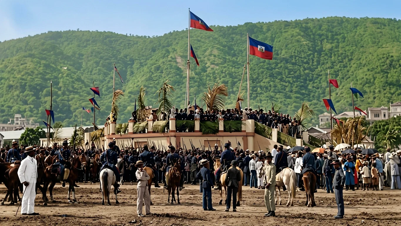
THE CELEBRATION OF AGRICULTURAL FETE, PORT AU PRINCE, HAYTI
A Portuguese inscription on one of the inner walls states that it was dedicated Dec. 20, 1666. Mozambique is the capital of Portuguese East Africa. Its residents are divided between Portuguese, Arabs, Indians, and African natives. The place is so hot that Europeans do not care to remain long in the town.