CHINA

5%

Pacific Press Publishing Company · Mountain View, California · Mar 6, 1907

FromSigns of the Times, Vol. 33, No. 10.

Read the full edition

CHINA.

I. Name, Territory, and General Features.
(Continued from last week.)
THE colonial possessions, or Central Asian dominions, of Mongolia, Ili, Thibet, and Kashgaria, or Chinese Turkestan, being so entirely beyond the radius of profitable commercial intercourse with the western world have been but little explored, and have always been a drain upon the Chinese Imperial Government.
Mongolia is known to be desert, for the most part, supporting but a sparse population in districts where scanty vegetation permits.
Thibet has large mineral wealth. Her natural trade outlet being over the Himalayas thru India, and the fact that the high plateaus and mountains of this steppe country form India's natural fortification against Russian encroachment, are inducements to Great Britain to press her suit at the court of the Dalai lama until not only trading points, as heretofore, but H'Lassa, the sealed and sacred city, and all Thibet and Turkestan shall be thrown open to foreign enterprise. It is God's method of preparing the way for the everlasting Gospel to go to every nation, kindred, tongue, and people.
Altho nominal dependencies of China, who keeps up the show of imperial authority, these lower Central Asian possessions are actually under control of the lamas. By this system of worship large numbers of the male population are drawn into monasteries.
While in China Proper Confucianism leads to polygamy, polyandrianism is the peculiar practise of the Thibetans. The wife of the eldest son by virtue of his choice becomes the wife of all the family of younger brothers. This choice is not obligatory, and if any brother prefers to leave the family and choose for himself, he may be free to do so.
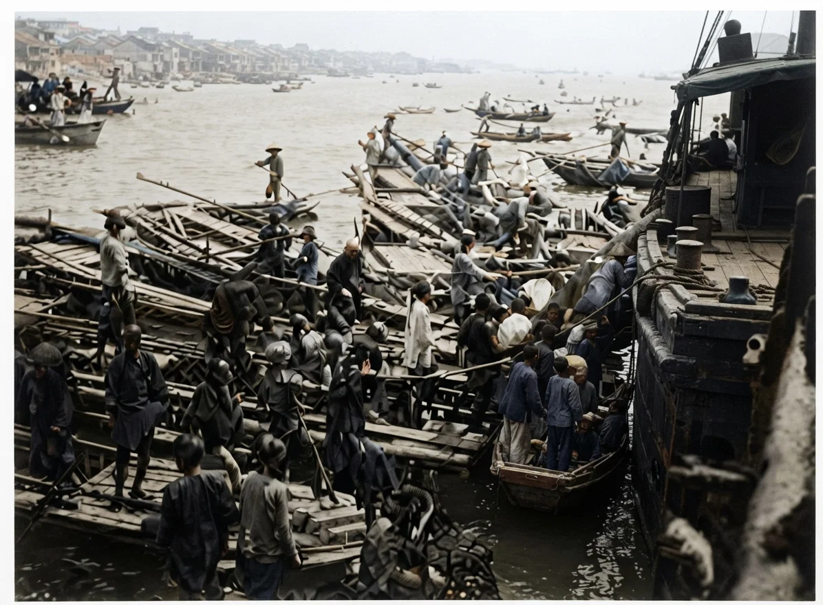
Small Boats around a Steamer Landing at Amoy, China. A Scramble for Patronage.

The Climate of China.

Between the tropical climate of the extreme south of China lying within the Torrid Zone, and that of Manchuria bordering onto bleak Siberia, there is a great variety of climate and productions. The climate of the coast regions is further influenced by warm ocean currents, and the temperature also falls as one ascends to the high table-lands of the mountainous districts of the west. On the whole, the climate of China is considered healthful, altho the lack of sanitary law, the crowded condition of the cities, and the poverty of the masses make promiscuous living among the Chinese precarious for foreigners.
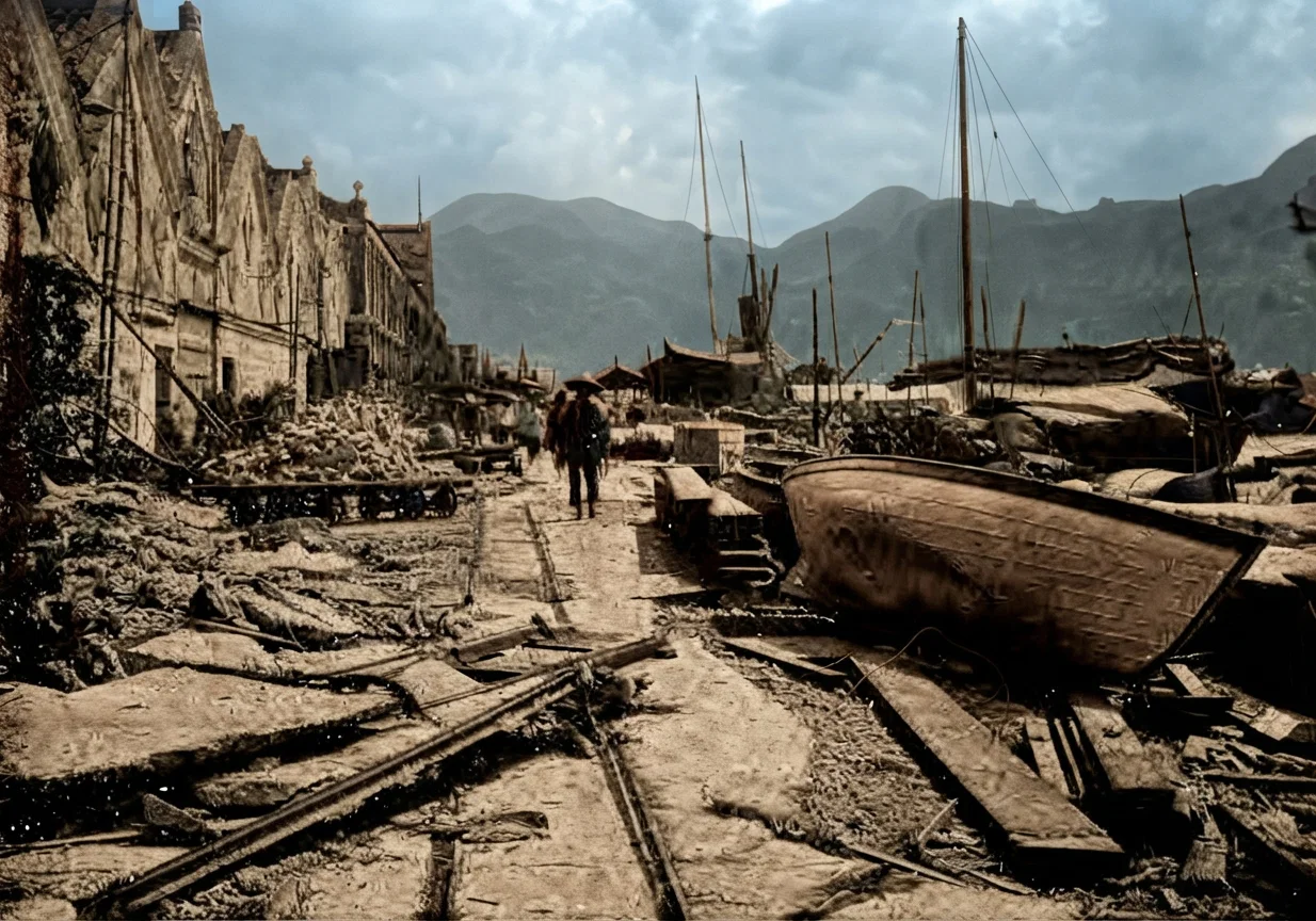
The Kowloon Side of Hong Kong Harbor after the Typhoon of Sept. 18, 1896.

The Rivers of China.

The physical contour of China Proper consists in general of high mountain ranges and wooded table-lands in the west, succeeded by mountainous and hilly country, where its rivers, breaking thru steep barriers, form immense gorges, the imposing grandeur of which add to the great natural beauty of scenery; and the region of the deltas of the Peiho, Yellow, Yangtse, and West Rivers. Between these deltas the mountain district reaches down toward the sea, sometimes in bold ranges and peaks, which do much to shut off communication between the sea and the interior. To the more level region of the delta belt may be ascribed one-third the area and two-thirds the population of China.
The Peiho, not a large river, but important as being a natural means of communication between Pekin and the Sea, empties into the Gulf of Pechili. The Hoangho, or Yellow River, sometimes designated as China's Sorrow, rising in the mountains of Mongolia, sweeps in a great bend to the north, several times intersecting the line of the Great Wall, then falling back into the plain, rushes out toward the sea, carrying with it the yellow alluvial from which it derives its name. It also empties its turbulent tide into the Gulf of Pechili. Nine times since the sixth century B.C. it has dammed up its own egress and broken out, sometimes with terrible results, in a new place of outlet, leaving its former course marked by cliffs and drifts of barren loess.
The largest and most important river of China is the Yang-tse-Kiang. It forms the main artery of trade communication between eastern and western China, being navigable, it is said, to a distance of 1,600 miles from the sea. From Shanghai to Hankow, a distance of 600 miles, it is easily navigable by large river steamers. Light draught boats penetrate 360 miles further to Ichang, while native junks carry trade 400 miles beyond. One who has made a survey of the region is authority for the statement that the present obstructions of rocks and whirlpools probably might be so overcome at no great expense that steamboats could cover the entire distance. Thru its tributaries, light draught steamers and native boats carry trade into a vast region both north and south of the Yangtse, thus opening to commerce one of the most fertile, productive, and populous districts on the earth's surface.
In the south, another great river, the Si Kiang or West River, taking its rise in the cool springs of the Himalayas, leaps down steep slopes, and after hundreds of miles thru most picturesque scenery between high ranges, narrowing at times to deep gorges, where the swift current is quickened into a rushing tide, it falls into the plain coast region about 150 miles from the sea. Left to leisure in the flat country, it breaks out into a multitude of streams and forms a network of waterways.
Just above the provincial city of Canton, the West River is joined by the North River, and thirty miles below receives the affluence of the East River. These three rivers drain a territory of not less than 150,000 square miles, and most of their channels are navigable for small boats to all the larger towns of Quang-tung and Quang-si provinces. Large river steamers navigate a distance of 200 miles, while slight improvements would enable them to reach Kweilin, the capital of Quang-si.
The estuary of West River forms one of the most remarkable deltas in the world, in the form of a triangle, not less than 100 miles on any side, embracing a network of slow waterways, enclosing low, fertile islands capable of producing three crops per year. In many parts these islands are "dyked" in and form the famous rice lands of South China. Each small farm or separate field is surrounded with an embankment crowned with fruit trees,—peach, plum, persimmon, litchie, orange, banana,—each vieing with the others in its season, while groves and hedges of bamboo add to the subdued beauty of the whole region.
EMMA T. ANDERSON.